69 GRAND ST
Owner Information
KEARNEY DAVID ETUX
69 GRAND ST
LEOMINSTER, MA 01453


Property Details
69 GRAND ST is classified as a Single Family Residential (Conventional).
The primary structure on this property was built in 1900. There are 2,538ft2 of built area within this property. There is 1,237ft2 of residential/living space within this property. This property is listed as having 7 rooms.
69 GRAND ST is valued at $257,000. The land is valued at $84,800 and the structures are valued at $172,200.
This property is in Zone RB. Confirm with local Zoning Board authorities to ensure there are no overlays or other easements on this property.
The most recent deed for 69 GRAND ST is recorded at the local registrar in Book 5339, Page 185. 69 GRAND ST was last sold on Monday, July 12, 2004 for $239,900.
Assessment data from fiscal year 2021.
Flood Data
According to the FEMA National Flood Hazard Layer, this property does not appear to be in a flood zone. It may also be in an area not yet reviewed. Nonetheless, confirm this information prior to taking any action.
To view the flood hazards around this property, create a FEMA "Firmette" Map of the area around 69 GRAND ST.
Broadband Internet Providers
| Provider | Type | Bandwidth (mbps) | |
|---|---|---|---|
| VSAT Systems, LLC. | Satellite | 2 | 1 |
| Verizon New England Inc. | Fiber | 940 | 880 |
| Comcast | Cable | 1000 | 35 |
| Verizon New England Inc. | DSL | 10 | 1 |
| Viasat Inc | Satellite | 100 | 3 |
| GCI Communication Corp. | Satellite | 0 | 0 |
| HughesNet | Satellite | 25 | 3 |
Broadband service provider data from December 2020.
Adjacent Properties
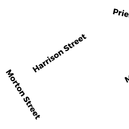
- 56 HARRISON ST
Two-Family Residential owned by RODRIGUEZ LUIS - 50 HARRISON ST
Single Family Residential owned by DEMAR CLARENCE W ETUX - 61 GRAND ST
Single Family Residential owned by BABIN SHELLEY A - 62 HARRISON ST
Single Family Residential owned by ARNOLD EDWARD J - 30 MORTON ST
Single Family Residential owned by COE WAYNE R ETUX